A powerful earthquake measuring 5.9 on the Richter scale struck western Iran near the Iraq border early this morning, sending tremors across the region and prompting emergency response teams to mobilize rapidly. The quake, centered approximately 15 kilometers northeast of the city of Qasr-e Shirin in Kermanshah Province, occurred at 6:42 AM local time, catching residents as they began their daily routines.
Initial reports indicate the earthquake was felt across multiple provinces in western Iran, with residents in Baghdad and other Iraqi cities also reporting noticeable shaking. The shallow depth of the tremor, recorded at just 10 kilometers below the surface, amplified its impact on surrounding communities. Kermanshah Province, which sits along one of the world’s most seismically active fault lines, has experienced several significant earthquakes in recent years, making residents acutely aware of seismic risks.
Emergency Response and Initial Damage Assessment
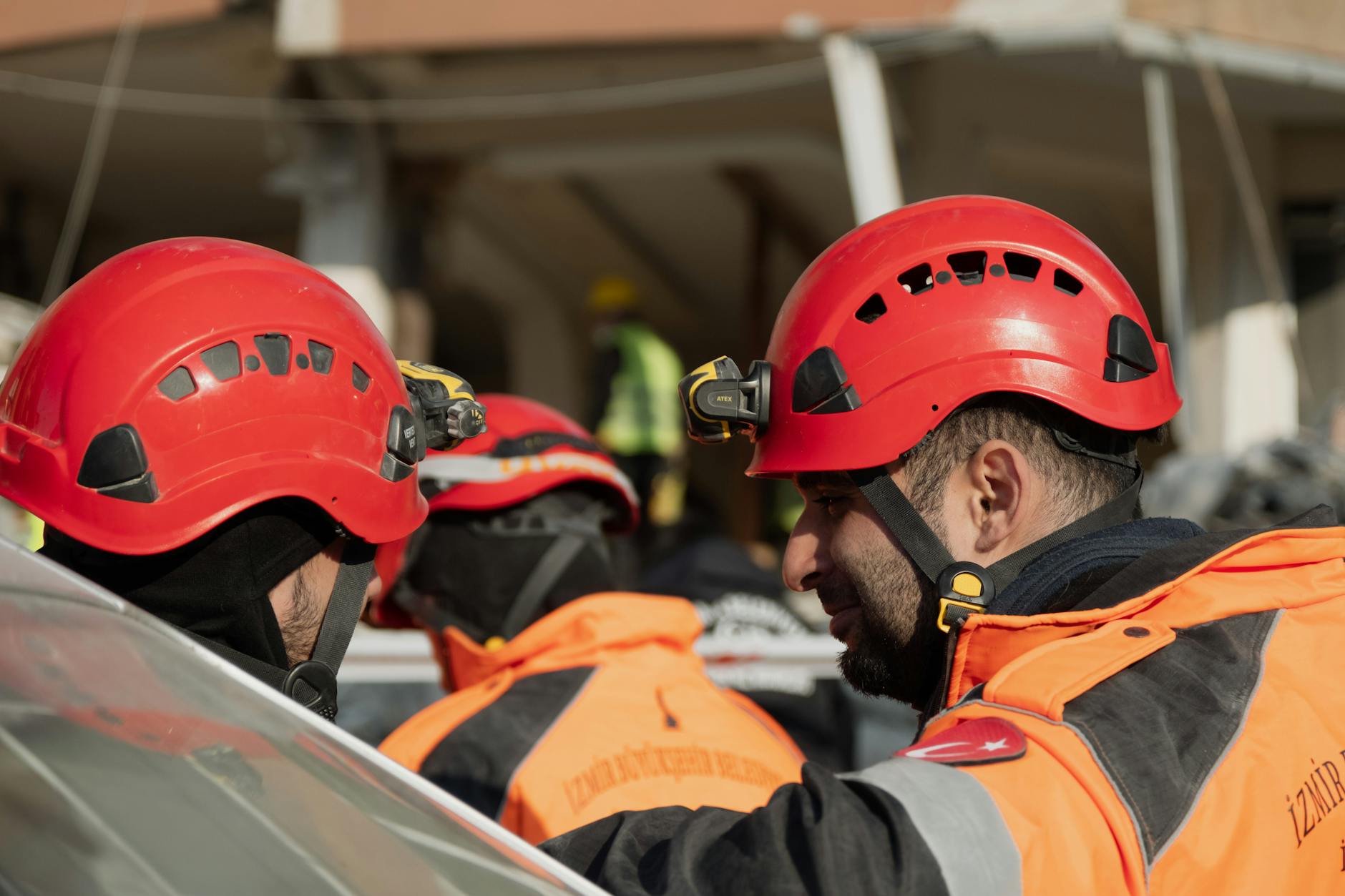
Iranian emergency services immediately deployed rescue teams to affected areas, with helicopters conducting aerial surveys of remote villages near the epicenter. Provincial governor Ali Akbar Razmi confirmed that search and rescue operations began within minutes of the initial tremor, focusing on rural communities where communication lines were temporarily disrupted.
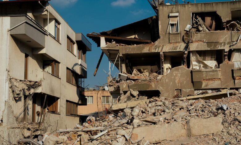
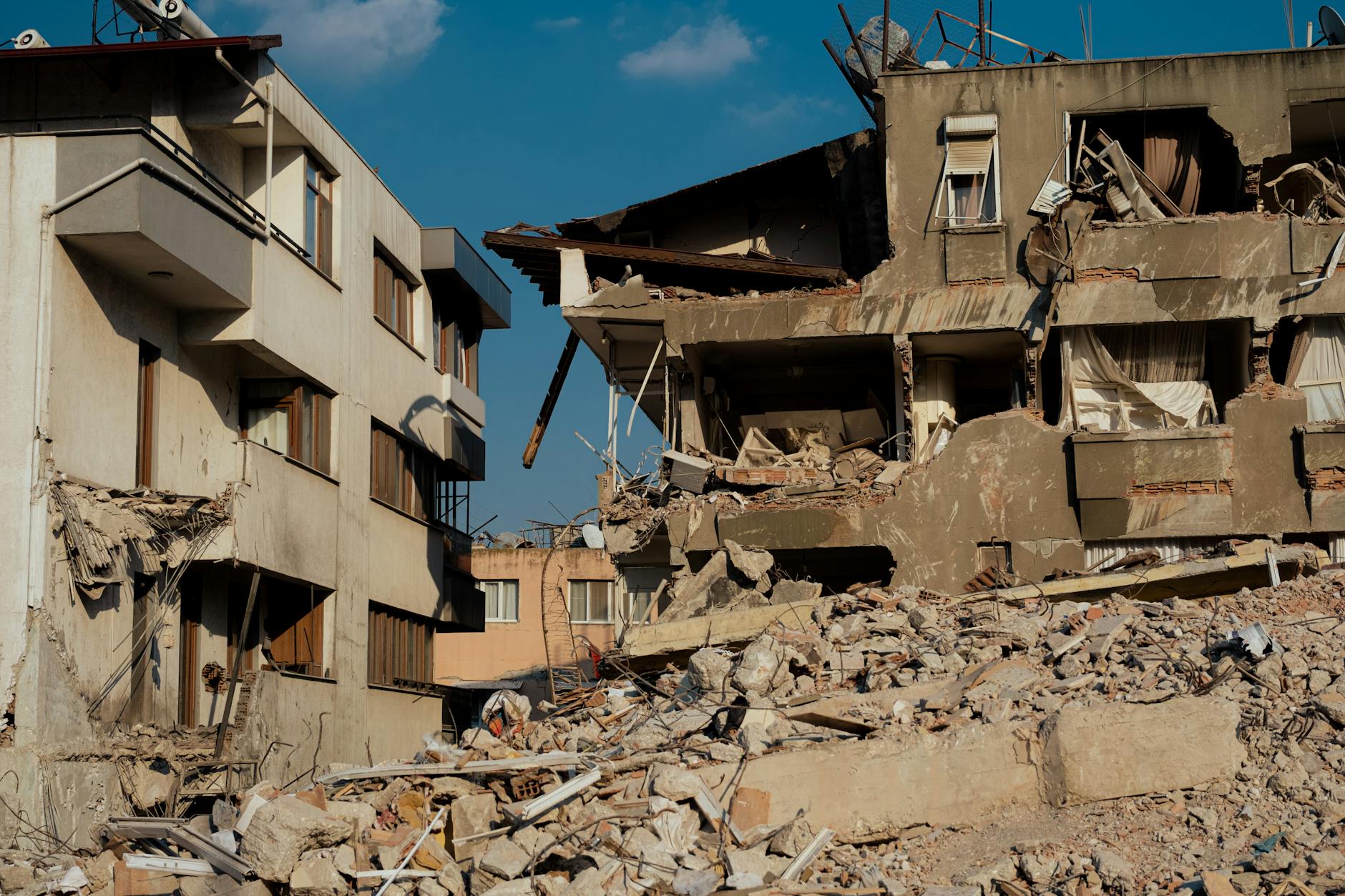
Early damage reports suggest several older buildings in Qasr-e Shirin sustained structural damage, including cracks in walls and damaged roofing. The city’s main hospital reported treating dozens of residents for minor injuries, primarily cuts from broken glass and bruises from falling debris. Medical facilities across the region remain operational, though authorities have activated emergency protocols to handle potential casualties.
Power outages affected approximately 30,000 residents across three districts, with utility companies working to restore electricity to critical infrastructure first. Water treatment facilities in the area underwent immediate safety inspections, with preliminary assessments indicating no major damage to essential services. Local schools and government buildings were evacuated as a precautionary measure while structural engineers conduct safety evaluations.
The Iranian Red Crescent Society mobilized emergency response teams from Tehran and surrounding provinces, establishing temporary shelters for families whose homes were deemed unsafe for immediate occupancy. Food distribution centers opened in affected areas, providing meals and basic supplies to displaced residents.
Geological Context and Regional Seismic Activity
Western Iran sits at the intersection of the Arabian and Eurasian tectonic plates, creating one of the most earthquake-prone regions in the Middle East. The Zagros mountain range, which extends across the affected area, formed through millions of years of tectonic collision and continues to experience regular seismic activity.
Dr. Mehdi Zare, a seismologist at the University of Tehran, explained that this morning’s earthquake represents typical activity for the region. “The Kermanshah Province experiences an average of 15 to 20 measurable earthquakes per year, though most register below 4.0 magnitude,” Zare noted. “Today’s 5.9 magnitude event, while significant, falls within expected parameters for this seismic zone.”
The region’s earthquake history includes several devastating events, most notably the November 2017 earthquake that struck near Sarpol-e Zahab, killing over 600 people and injuring thousands more. That magnitude 7.3 earthquake, one of Iran’s deadliest in decades, led to improved building codes and enhanced emergency preparedness protocols across western provinces.
Similar to recent natural disasters that have tested emergency response systems nationwide, including the severe tornado outbreak that devastated multiple Midwest states, this earthquake highlights the critical importance of disaster preparedness and rapid response coordination.
Cross-border monitoring stations in Iraq also recorded the tremor, with seismologists in both countries sharing data to better understand the earthquake’s characteristics and potential aftershock patterns. The collaborative approach to seismic monitoring has improved significantly in recent years, enabling more accurate early warning systems for border communities.
International Support and Recovery Efforts
The Iraqi government offered immediate assistance to Iranian authorities, with border crossings prepared to facilitate the movement of emergency supplies and personnel if needed. This cooperation reflects improving diplomatic relations between the neighboring countries and their shared commitment to disaster response.
United Nations disaster relief coordinators in the region are monitoring the situation closely, ready to provide additional support if requested by Iranian authorities. International seismic monitoring networks, including the European-Mediterranean Seismological Centre, confirmed the earthquake’s magnitude and location, providing valuable data for ongoing geological research.
Recovery efforts focus on temporary housing solutions for affected families, infrastructure repairs, and psychological support services for residents traumatized by the experience. Local mosques and community centers opened their doors to provide shelter and comfort to those displaced by the earthquake.
Economic impact assessments began immediately, with particular attention to agricultural areas and small businesses in affected communities. The timing of the earthquake during harvest season raised concerns about crop storage facilities and agricultural equipment, though initial reports suggest minimal damage to farming infrastructure.
Moving Forward: Preparedness and Recovery
As aftershock monitoring continues, authorities emphasize the importance of ongoing vigilance and preparedness. Seismologists expect several smaller aftershocks over the coming days, though none are predicted to exceed the magnitude of this morning’s primary event.
The earthquake serves as a stark reminder of Iran’s vulnerability to seismic activity and the ongoing need for robust building standards, emergency preparedness, and community education programs. Local authorities are using this event to reinforce earthquake safety protocols and evaluate the effectiveness of current emergency response procedures.
International geological cooperation will likely intensify as scientists analyze data from this earthquake to improve understanding of regional seismic patterns. This research proves essential for developing better early warning systems and building codes that can protect communities from future seismic events.
Recovery efforts are expected to continue for several weeks, with focus shifting from immediate emergency response to longer-term reconstruction and infrastructure improvements. The resilience demonstrated by affected communities, combined with swift emergency response, offers hope for a complete recovery from this morning’s seismic event.
Frequently Asked Questions
How strong was the earthquake that hit Iran?
The earthquake measured 5.9 magnitude on the Richter scale and occurred at a shallow depth of 10 kilometers.
Were there any casualties from the Iran earthquake?
Initial reports indicate minor injuries treated at local hospitals, with emergency teams continuing damage assessments.